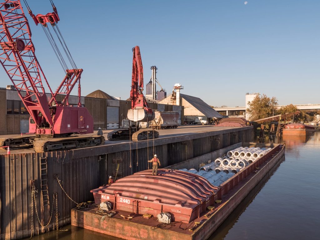
River Terminal
The Port of Little Rock Terminal is located at Mile 112.8 on the right descending bank of the Arkansas River. It is located just south of the I-440 Bridge, with excellent access to interstate highways, connecting to both Interstate Highways 30 and 40, as well as having easy access to rail and barge service.
The Port of Little Rock Terminal:
- Cargo Lift Capacity: 50 tons
- Bulk Handling Capacity: Inbound – 200 tons/hour; Outbound – 350 tons/hour
- Industrial Harbor: 4500 feet long, 320 feet wide, 15 feet deep
- Storage: Inside – 134,000 square feet; Outside – 15 acres
- Truck and Rail Scales
- Roll On/Roll Off Ramp
- COFC Lift Capacity
- Chemical and Grain Packaging from Rail, Truck or Barge
Its location on the Arkansas River (a part of the McClellan-Kerr Arkansas River Navigation System) allows the Port of Little Rock Terminal to offer its customers a cost-effective method of transporting cargo by barge. The Little Rock facility provides water access to cargo heading both west and east on the Arkansas River. The navigable headwaters of the river start at Mile 448 in the Tulsa/Catoosa area and end at Mile 0, just north of Rosedale, Mississippi, located at Lower Mile 589 on the Mississippi River.
The terminal is leased on a long-term basis by Logistic Services, Inc. (LSI), a professional stevedoring company specializing in the handling of bulk, steel, and general cargoes. LSI handles multiple cargos to and from railcars, trucks, containers and barges or any combination thereof. LSI also offers warehousing/outside storage services and limited packaging services. Common commodities transported include:
Forest Products
- Rolled/Baled Paper/Pulp
- Bundled Plywood/Pressboard
- Bundled Lumber
- Bagged Goods
Metal Products
- Rolled/Baled Paper/Pulp
- Bundled Plywood/Pressboard
- Bundled Lumber
- Bagged Goods
Bulk Products
- Agri-Products, such as rice
- Clay
- Bauxite
- Rock
- Fertilizer
- Cement